In today’s world of technology, these two concepts play a vital role- GPS and GIS. as we know what a GPS is, right? From travelling to finding an exact location, we opt for GPS.
However, GIS looks into tracking, mapping, storing, and analyzing to display geographical data in a computerized form.
Key Takeaways
- GPS is a satellite-based system that provides location information, while GIS is a framework for managing spatial data.
- GPS technology enables tracking and navigation, whereas GIS supports analysis and decision-making.
- GIS can incorporate GPS data to create more accurate and detailed maps.
GPS vs GIS
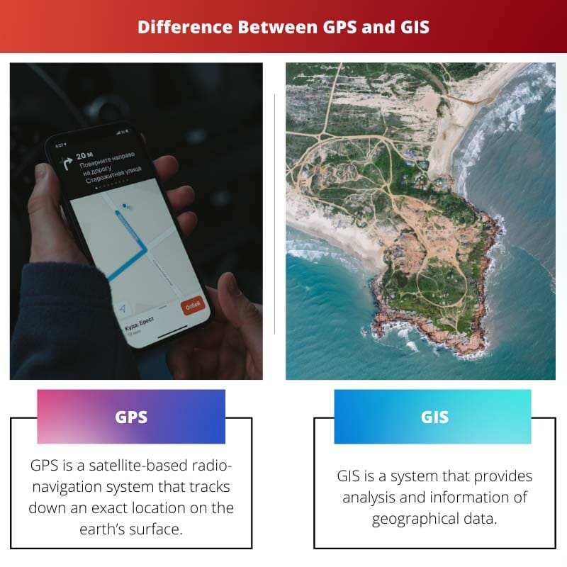
GPS (Global Positioning System) is a satellite-based navigation system allowing users to determine their precise location and track real-time movements. GIS (Geographic Information System) is a computer-based tool that enables users to capture, store, analyze, and manage geographic data.
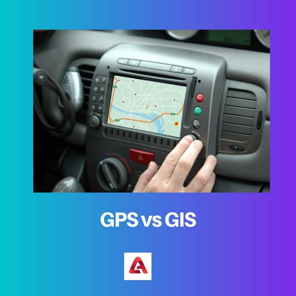
GPS is a very common technology used for navigation. Moreover, it is basically used to track down one’s location on the surface of the earth through satellite-based radio navigation.
Locating positions, getting access to emergency roadside support, preventing automobile theft, and mapping & surveying are a few services pitched in by using GPS.
Meanwhile, GIS is a system that provides analysis and information on geographical data.
Geographic information systems are used for mapping, transportation and urban surveying, natural resources management, agricultural value chains, and health analysis.
The term GIS (Geographic Information Science) also refers to the study of geographical concepts, applications, and systems.
Comparison Table
| Parameters of Comparison | GPS | GIS |
|---|---|---|
| Meaning | GPS is a satellite-based radio-navigation system that tracks down an exact location on the earth’s surface. | GIS is a system that provides analysis and information of geographical data. |
| Etymology | U.S Department of Defense in 1978, launched its prototype spacecraft known as the GPS project. | In 1963, Roger’s Tomlinson along with the Canadian Government invented GIS to maintain a manageable inventory of natural resources. |
| Application | Application to Locating positions, Getting access to emergency roadside support, preventing automobile theft, and mapping & surveying. | GIS applications are Mapping, Transportation & Urban surveying natural resources, Risk & Disaster Management, Agricultural Value Chain, and public health analysis. |
| How does it work | Atomic clock is installed in GPS satellites; where broadcasting can be determined by the receiver, the satellite embeds time information. | GIS is a computer-based system that stores, analyzes, displays geographical data of the Earth’s surface in shared drive files. |
| Acronym | Global Positioning System | Geographical Information System |
What is GPS?
GPS is used to track down one’s location on the surface of the earth through satellite-based radio navigation. Moreover, GPS is a very common technology used by people, alias drivers for navigation purposes.
The U.S. Department of Defense initiated the first GPS in 1978 as the prototype spacecraft project for navigation purposes.
Bradford Parkinson, a professor of aeronautics and astronautics at Stanford University, later became the patent of a satellite-based system and developed it with the help of the U.S. Air Force, which is now renowned as GPS.
The word GPS is a short form/ acronym of Global Positioning System. Speaking of GPS applications other than navigation, it is used for locating positions, getting access to emergency roadside support, preventing automobile theft, and mapping & surveying.
An atomic clock is installed in GPS satellites, which thereby enables broadcasting. Eventually, the satellite embeds time information in its codes, and a receiver is placed on the other end to decode the information promptly.
GPS features real-time navigation, alongside enabling notification reports on history, fuel savings, Geofencing, and Point of Interest tools, and is mobile-friendly.
However, GPS is occasionally disadvantaged, such as its inaccuracy, lack of local knowledge, driving distraction, signal or battery failure, privacy issues, and commercial exploitation.

What is GIS?
On the one hand, GIS is a system that provides analysis and information on geographical data. While on the other hand, the term GIS (Geographic Information Science) refers to the study of geographical concepts, applications, and systems.
Sometime around the year 1963, Roger’s Tomlinson, along with the Canadian Government, invented a system to maintain a manageable inventory of natural resources.
The acronym GIS stands for Geographical Information System.
GIS is mostly used for functions like Mapping, Transportation & Urban surveying of natural resources, Risk & Disaster Management, Agricultural Value Chain, and public health analysis.
Geospatial Information Systems (GIS) is a computer-based system that stores, analyses, verifies, and manages information on geographical data.
GIS features location, temporality, field-based approach, complex spatial, thematic value, and fuzzy objects in a way to report geographical information.
There are a few benefits of GIS, such as managing assets, and parcels, better-informed decisions, central location, and delivering a clean and clear display of information.
Speaking of the disadvantages of GIS, it can be expensive in some cases, and cryptic code doesn’t provide absolute solutions, integration with the traditional map is difficult and requires an efficient processor and higher storage space.
Five components are essential to a GIS’s functionality: hardware, software, data, people, and methods.

Main Differences Between GPS and GIS
- GPS is a satellite-based radio navigation system used to pinpoint a precise location on Earth. On the other hand, GIS is a system that analyses and reports on geographical data.
- GPS was launched by the U.S. Department of Defence in 1978, whereas GIS was introduced by the Canadian Government in 1963.
- GPS is mainly used for tracking any location, getting access to any exigent roadside, supervising the prevention of theft, and mapping & surveying roads/locations. On the contrary, GIS is applied for producing maps, managing transportation & urban planning, risk & disaster management, and examining agricultural value chains.
- A receiver can determine transmission using an atomic clock installed in GPS satellites, and the satellite embeds time information in its codes. Meanwhile, GIS demanded information regarding geographical data to be stored, analyzed, checked, and displayed in a shared drive file.
- Global Positioning System is the acronym of GPS, Notwithstanding that, GIS expansion is Geographical Information System.
- https://onlinelibrary.wiley.com/doi/abs/10.1002/j.2161-4296.1978.tb01326.x
- https://books.google.com/books?hl=en&lr=&id=VN1v7rzhSQEC&oi=fnd&pg=PA1&dq=gis+meaning+&ots=jy4OhPvBjq&sig=kE6wZDYeMkpBKH_ZmCSh6Ah0vdY

The explanations about the differences between GPS and GIS are really insightful. I appreciate the comprehensive nature of the article.
This article does an excellent job of explaining the differences between GPS and GIS. The diagrams are particularly helpful.
This is a very detailed and informative article. I appreciate the clarity and depth of the content.
I agree! The article does an excellent job of breaking down the definitions and uses of the two technologies.
The article is impressively rich in content. It offers a thought-provoking comparison of GPS and GIS that contributes significantly to a deeper understanding of the technologies.
This article contains a wealth of valuable information that is skillfully presented. The eloquence of the writing contributes to its credibility.
The author thoroughly explores the applications and functionalities of GPS and GIS and presents the information in an organized manner.
The detailed information about the working of GPS and GIS is intriguing. This article serves as a valuable resource for understanding the topic.
Agreed, the comparisons are well-articulated and provide a comprehensive understanding of GPS and GIS technology.
I find the content of this article to be exceptionally beneficial. The author has demonstrated a high level of expertise on the subject matter.
The in-depth analysis is praiseworthy. The article provides valuable knowledge through a systematic comparison of GPS and GIS.
I could not agree more. The expertise and insights reflected in the article are commendable. This truly contributes to the enhancement of knowledge.