The Global Positioning System (GPS) and Chartplotter are two technically different terms but can be used interchangeably. Both terms are used in the coordination that will provide the exact position of an object.
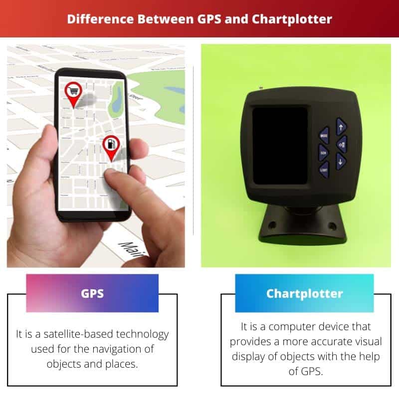
A Global Positioning System is a type of navigation system that is based on a satellite, whereas a Chartplotter is a device that is used to integrate the GPS data with an electronic chart.
Key Takeaways
- GPS is a satellite-based positioning system that provides location information, while Chartplotter is a device that uses GPS data to display electronic charts.
- GPS can be used in various applications, including navigation, surveying, and geocaching, while Chartplotter is primarily used for marine navigation.
- GPS is a technology, while Chartplotter is a device that utilizes GPS technology to provide navigation information.
GPS vs Chartplotter
GPS stands for Global Positioning System, which consists of 24 satellites in six orbits that revolve around the earth every 12 hours, used for precisely finding people. A chartplotter is a device or a stand-alone computer that shows the exact location of an object or a person on the map.
The Global Positioning System was earlier known by another name, and that was Navistar GPS. It consists of 24 satellites in 6 orbits that revolve around the Earth every 12 hours.
The development of GPS was for use by the military people and was considered less precise for the civilians around the earth.
The Chartplotter is used as a device or as a stand-alone computer that displays the exact location of any object on a map and also plots very accurate places.
To be able to see a complete navigation package, the GPS chips are embedded into the chart plotter.
Comparison Table
| Parameters of Comparison | GPS | Chartplotter |
|---|---|---|
| Definition | It is a satellite-based technology used for the navigation of objects and places. | It is a computer device that provides a more accurate visual display of objects with the help of GPS. |
| Function | It performs main three functions and that are the space segment, control segment, and user segment. | It gives information about water depth, obstruction on the way, and the environment. |
| Cost | GPS systems are quite cheap | These are expensive as compared to GPS |
| Characteristics | It does not need a screen rather, it gives the information in numeric form | It is very easy to use and also needs a screen to view graphics |
| Uses | GPS is mainly used for location purposes in mobile phones, cars, etc. It is also used in tracking, surveillance, and studying atmospheric conditions. | Mostly used in marine navigation to have a view of the ship and other objects around it. |
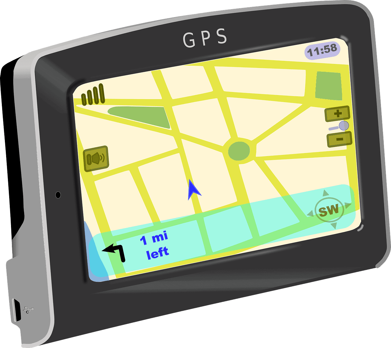
What is GPS?
The Global Positioning System (GPS) was developed for military purposes in the year 1973. It was mainly used for positioning, navigation, and timing services.
GPS consists of three key components: GPS satellite, GPS receiver, and computer software that help to interpret the signals and be able to find the geographical position of the user.
This technology gained a lot of importance because it used the satellites that are present in the earth’s orbit and measured the distance between the satellite and the user.
According to some of the reports, there are around 30 satellites that are constantly revolving around the orbit at a very high altitude and emit the high-frequency radio signal that has been received by the GPS receivers, which is one of the important components of GPS.
The GPS is controlled by the US government, which is the reason it is very difficult to assess. It is mainly used to assess the position of military, civil and commercial users.
Hundreds of users are trying to decode the satellite signals that have been installed in automobiles, submarines, etc.
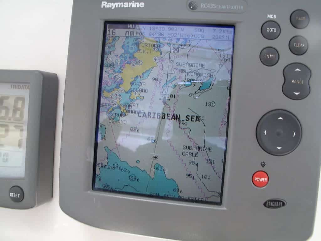
What is Chartplotter?
A Chartplotter needs a GPS to interpret the position given in the form of latitude and longitude in a graphic view. So, it can be said that all the chart plotters can use GPS, but without a Chartplotter, GPS is much simpler to use.
Chartplotters can be used in both ways, either external or internal. The detection of various locations can be done by the Chartplotter user interface.
The standard computer and various other devices operate on some software while some others run on advanced software. The use of a highly efficient Chartplotter gives a three-dimensional view of fishing and other obstructions in the route.
The data collected by the Chartplotter can be stored for future use as well. That is the reason there is a minimal chance of losing the data.
The Chartplotter can be of two types and have been provided by the device, and those are Raster charts and Vector Charts.
The raster chart shows a picture of a paper map according to the geographical coordinates, whereas the vector chart makes a replica of that chart by using the raw data from the coded information.
Main Differences Between GPS and Chartplotter
- GPS is a satellite-based technology used for navigation purposes, whereas a Chartplotter gives a graphical view of a map.
- GPS gives numeric code for the location in the form of latitude and longitude; hence, it is difficult to interpret, while a Chartplotter presents an understandable image of the location.
- GPS is a complex system involving satellites and proficient computers, whereas a Chartplotter is a simple system showing objects on the map.
- GPS can be used on its own, whereas Chartplotter needs GPS internally or externally to work.
- A GPS device is only used by expert navigators who are experts in reading longitudes and latitudes. On the other hand, a Chartplotter can be read by a person having less knowledge of navigation.
- https://www.worldscientific.com/doi/abs/10.1142/9789814287951_0088
- http://acwi.gov/sos/pubs/2ndJFIC/Contents/P09_Hall_12_18_09_abstract-for-papers.pdf

I found the article very informative about the technical aspects of GPS and Chartplotter, but it seems a bit dense.
I agree, it certainly requires some technical knowledge to fully understand.
I appreciate the detailed comparison of GPS and Chartplotter.
I’m really impressed by the detail with which the differences between GPS and Chartplotter are explained in this post.
I think the cost comparison provided for GPS and Chartplotter is oversimplified.
The comparison table was very helpful to understand the distinctions between GPS and Chartplotter.
The article gives a clear idea of GPS and Chartplotter functionalities.
I think the comparison table was easy to comprehend.
I loved the detailed explanation of the functioning of the GPS system and the Chartplotter. Great job!
I found the technical details fascinating.
It might be too technical for some readers.
The explanation of the differences between GPS and Chartplotter could be more engaging for the readers.
I think it’s necessary to maintain the technical depth to accurately explain these concepts.
The article effectively discusses the technical aspects of GPS and Chartplotter.
I found the comparison between GPS and Chartplotter very interesting.
The article provides comprehensive details about GPS and Chartplotter, it’s definitely beneficial for someone looking to learn more about this topic.
I think they’ve done a great job breaking down complex technical information into understandable points.